On Friday, May 22nd, my brother and I bagged our third highpoint en route to our goal of all 50 states, at Sassafras Mountain, South Carolina.
We had made plans to do this highpoint (along with Georgia’s) at the end of March, or in April, but of course COVID-19 changed everything this year. We have waited patiently until restrictions have been lifted, and with the southern states reopening in the past few weeks, decided that Memorial Day would be a good time for both of us to take two days to do these hikes. I haven’t been out much in the past 10 weeks (only the one “trip” to Hanging Rock on Mother’s Day), so I was REALLY looking forward to this, and I know my brother was too.
It rained ALLLLL last week (or so it felt). I realized our hikes were going to include rain, unfortunately, but we decided to go anyway. Neither of us had any worries about coronavirus; thankfully we’ve both been healthy and haven’t been exposed to anyone. We brought masks and hand sanitizer, but figured since it was going to rain, there wouldn’t be many people out. I made plans for us to drive to SC first, then after our hike(s), we’d head over to a campground in the Hiawasee area of GA, near Brasstown Bald, Georgia’s highest point, and do some tent-camping there.

Joel arrived Thursday night, and I had most of our items for car camping already packed when he arrived. We had his Yeti cooler, Dad’s tent, Mom’s trekking poles (I still haven’t bought my own–but I need to, they are knee- and ankle-savers!) a box of snacks, my camera and tripod, sleeping bag and mat, extra shoes and socks, and a cast iron skillet to cook breakfast the next day.

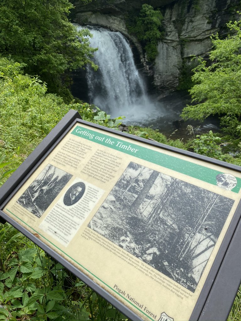
We got up around 7, and left after breakfast, at 8. We did a quick Dunkin’ Donuts stop for Joel to get coffee, then headed west on I-40 towards Asheville. Per usual, we chatted non-stop, and the 3 hours to our first stop passed in a flash–especially since we made no bathroom breaks. Our first stop was a quick detour: I had noticed Looking Glass Falls on the map, so close to Brevard, and wanted to stop there since we both love waterfalls! Plus, it was an easy stop, so close to the road.
We found it easily enough, despite no cell signal, and there was only 1 other car on the roadside parking area. I had to make a quick trip up to the woodline, since the 12 oz of coffee from home was in my system. I asked Joel to get my camera out, so when I got back to the car, I could start snapping away. Unfortunately, technical difficulties… my camera didn’t work! I tried several checks, but could not figure out what happened. Good thing my new iPhone 11 takes wide angle pics!


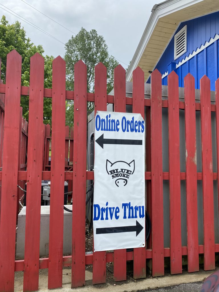
The route down to the falls was closed due to COVID, but we enjoyed the views up top for a few minutes. We got there at just the right time, because many cars pulled up as we were leaving. Twenty minutes down the road… I had planned for a BBQ break in Brevard, NC. Since we didn’t get any traditional North Carolina barbecue when we hiked Mount Mitchell in February (too tired!), I wanted to make it up to Joel. We pulled into the drive-thru of the small but mighty Blue Smoke BBQ around 11:30.
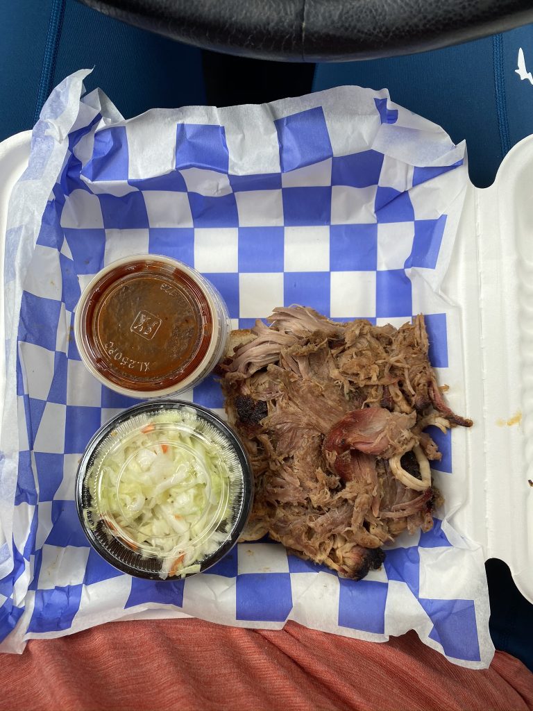
I ordered the pull pork plate, and Joel got the pulled pork tacos. We decided to split a piece of fluffernutter pie for dessert (mmmHMMM!) My tummy grumbled; very grateful for their quick service (and disinfectant solution for my debit card…lots of new germ-reducing practices out there now). We drove the half hour of back roads to Sassafras Mountain, munching on very crispy yummy fries on the way.

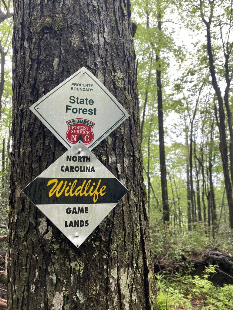
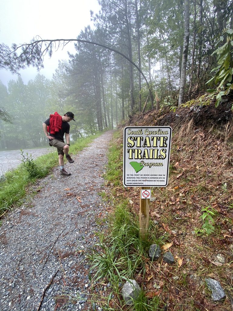
The parking lot only had a few cars. We ate lunch in the car, since it started to rain a bit. Joel needed to change clothes, and of course, all the public restrooms anywhere are still closed. Reminders of the global pandemic were all over:

I finished up my lunch (we saved the dessert for later), and headed up the quarter mile–if that!–to the summit of the highest peak in South Carolina, at 3,553 feet:


We laughed at how easy this felt compared to our last highpoint, Clingmans Dome. It only took two minutes from the parking lot to the top, so it almost felt like we cheated somehow. Note: There were longer approaches available, on trails like the Foothills Trail, but I told Joel I’d rather do a more scenic hike like Table Rock Trail, a 30 minute drive away.


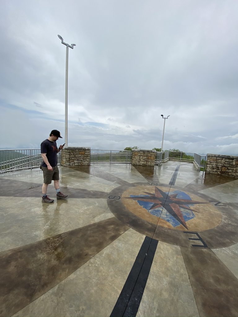
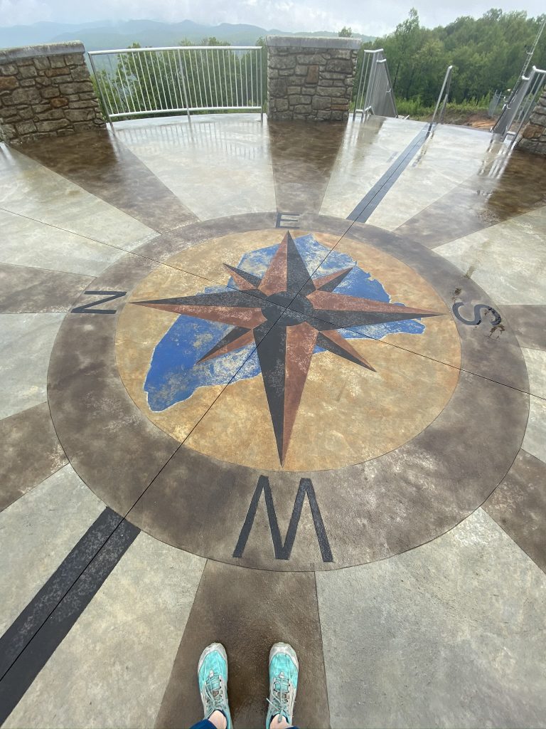


We took our obligatory “Made-it-to-the-top” photos, then went for a little walk down the Foothills trail, which straddles the border of North and South Carolina. We wanted to make the trip worthwhile before heading over to do a longer hike at Table Rock State Park.


We grabbed our raincoat (me) and sweatshirt (him) from the car, then did an out-and-back on the Foothills Trail, across from the parking lot.

Glad to bag our third highpoint (and the easiest of the 3 by far!), we celebrated with our little slice of Fluffernutter pie, which was exceptionally tasty (and we made it disappear before I could get a pic!), then headed down the road to Table Rock State Park–without a good map or GPS!

My Strava data:
Next up: Table Rock Trail, then Georgia’s highest point, Brasstown Bald.
Beautiful review and pics! My Daddy will be 82 on May 22nd (date you posted). He and I enjoy the great outdoors and are currently doing the SC Ultimate Outsider Challenge (visit all SC state parks). He’s still very active with cycling and walking, but due to his age, I choose the easy trails so as not to put him at risk for falling. I know this is now a paved access from parking lot to observation deck, but my concern is the grade. Is this something he could safely navigate up AND down since he would not be trying to support himsef against a tree or rail? I don’t want to think it’s steep enough to make him feel a lot of strain on knees, especially going back down. This is on my list of “must see” attractions, but I’m debating if I should share this adventure with my Daddy or someone else.
Also, is the drive back down the mtn a really steep grade? I have fear if driving in mtns that make me feel like I may be a runaway train with foot riding on the brakes the entireway down.
Thank you for any advice or suggestions.
Hi Gigi! Apologies for the very long delay here–just realized my comments notifications aren’t coming thru.
Hopefully you have made it to Sassafras Mountain by now. It’s very flat at the top and I think your dad could manage.
The roads were not steep either, if I remember correctly. Let me know if you go! Happy Trails 🙂