Hike: On 9/16/2020, we hiked the highest peak in North Dakota (2 days after hiking Black Elk Peak, SD). At 3,506 feet, this was our lowest elevation hike thus far in our Highpointing journey, and ranks as #30 of the 50 US States, just behind South Carolina. This was our first hike that wasn’t through public land, or through a forest. We also found a fun (or scary!) surprise at the top.

Goal: To complete our 8th highpoint safely, with our extra “guest stars” in tow–both parents, and Asher! We also needed to keep moving along (not “dilly dally”) since we had more driving yet to do that day.
Gear: I had my Osprey daypack with first aid kit, water, snacks, space blanket, Canon camera. I wore a visor, tank top, capris, Smartwool socks, Altra Lone Peak shoes. Plus sunglasses and trekking poles, though the poles weren’t really needed (Dad used them on the way back).

Weather: 60’s and sunny–near perfect!
Pre-Hike: We visited Theodore Roosevelt National Park earlier in the day, and ate pizza for lunch in the car. We found the trailhead with no issues, and got ready to hike within a few minutes. My only issue was the need for a bathroom… I decided I’d wait til there was some kind of cover! It was very wide open spaces there.

Also, another car pulled up as we were about to set off. It was a group of 3, two parents and their grown son. They had also hiked Black Elk Peak on Monday! After they said that, I recognized them from passing them on our way back from the peak. We said we’d see them at the top! I believe the son said he only needed 4 more peaks and he’d have all of the lower 48 completed.
Hike: The trail follows a fence, with cow pastures on either side, for about the first mile. Joel and Asher raced along, and I figured A would fizzle out (he didn’t). Asher also tried, unsuccessfully, to catch some grasshoppers. Joel helped 🙂


Cows dotted the field to our left:

I had a helpful comment/thread from AllTrails.com printed out, with directions, just so we wouldn’t get lost. She had written: Recommend staying on the two-track Jeep road that runs along the fence as rattlesnakes are native to the area. Little did we know, we would shortly find out the truth in this statement.

So we walked along the “Jeep road” until we reached the gate, with a nice sign to confirm we’re on the right path:

Then the trail started curving upwards, with rock cairns marking the way.

The steepness increased, and Asher’s running caught up with him. He stopped and waited for me, panting, “I’m tired.”
I gave him some Gatorade, and whispered to Joel, “You might need to carry him.”

But we were nearly at the top, and surprisingly, little Asher (age 6) went bounding up the trail. Thankfully he waited for us at the top… you’ll see why in a minute.
Just a few more minutes, and we were at the top!
We signed the trail register and of course, took pictures 😉 We celebrated and made a big deal about Asher completing the 1.75 mile (one way) hike, with nearly 500 ft elevation gain. And his first state highpoint!


Dad wanted to check out a sister peak in the distance, but as he walked that way, he came across what I hope to never come across during a hike (though we did see a baby one on the PCT):
A rattlesnake.


And my dear father wanted to see how long it was, so he borrowed my trekking pole and tried to get it to uncoil. Meanwhile, my mom and I were like “noooooo!”
The video below is worth a watch:
The rattlesnake telling us to go away!
We slowly backed away, and I was VERY glad that Asher didn’t come across the snake while he hiked ahead of us earlier.

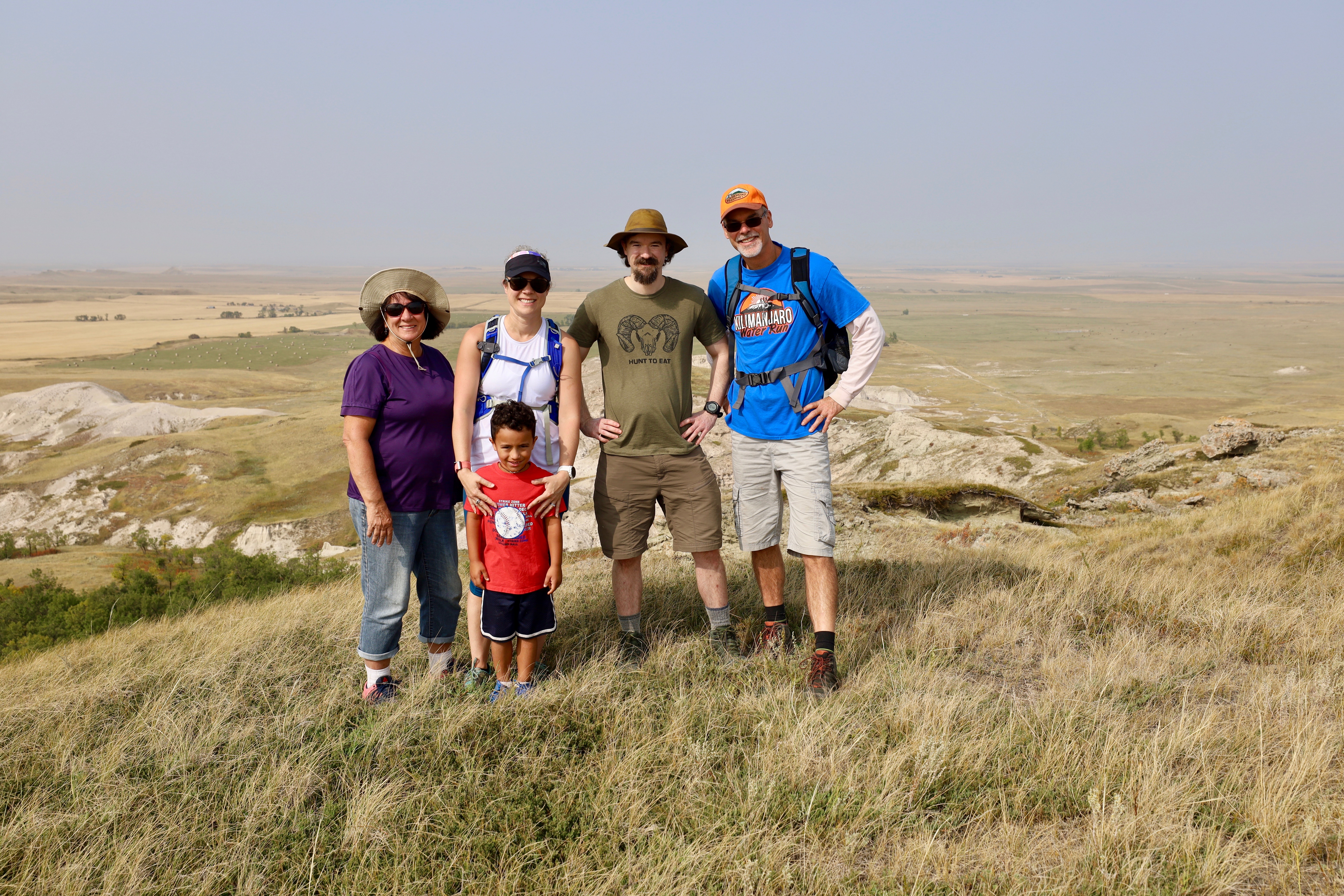
The folks from the parking lot came up afterwards, and we chatted for a few. They were the “Muggle” family (their nickname). They took our family picture, posted above, and we took theirs.
The way back seemed easy… I stopped for a bathroom break behind some bushes, and otherwise just enjoyed the scenery! (and tried to walk quickly, so we wouldn’t get to Deadwood super late)


I told Asher he could play in the sand on the way back (anything to spur him on!) so of course, he did…

Recommend: Well… yes if you’re in the area (or you’re highpointing like we are!) This was beautiful scenery for sure, and out of the norm for me (no tree cover whatsoever). That said, it wasn’t one of the more challenging or exciting highpoints (I’d give top marks so far to Mount Marcy and Mount Mitchell)–however, that rattlesnake did make it more heart-pounding!
Maps:

Up next: I think West Virginia is up next–easy and pretty close to home (5 hours). We might make it a 3-fer with MD and PA.
Highpoint #8 done!

What a flat, tree-less state North Dakota is. Asher is to be commended for sticking with you – all the way.
His energetic self has become your blogs’ mascot. The arrowhead necklace has magical powers.
As for the rattlesnake encounter, now we see why Mr. Forbes used your trekking pole. Yikes.
Love your mother’s hat – got one just like it. Great minds.
No surprise that the Dakota’s are big Trump fans. When your journey is said and done, you will have to
advise me the top five states that are “must see.” Hopefully, these five will offer meals other than bison burgers
and elk poop stout.