Hike: Our third highpoint in 3 days (after WV and MD), we hiked to the most unique highpoint (you’ll see why!) thus far, Mount Davis, PA on 11/10/2020.
Mount Davis is #33 of the 50 states’ highpoints, just behind Maryland. At 3,213 feet, it is the lowest elevation highpoint that we’ve done so far.

Mount Davis is located in the Forbes State Park (ironic for several reasons, since my maiden name is Forbes, and because I never knew this state park existed! And PA is my home state), in Elk Lick Township, only an hour up the road from Deep Creek Lake, where we stayed the night prior.

Goal: I needed to get on the road for a 6 hour solo drive back to NC, so I wanted to see the highpoint and hike the area before 11:30 (to be home by dinner!). Safety was not much of a goal here, since the highpoint was not far from the parking lot.
Gear: I had 2 layers on at the beginning, since the morning was quite chilly. I had my backpack with food, water, first aid, and I left my trekking poles at the van, thinking it would be mostly flat (I was wrong).
Weather: 59° and sunny 🙂 The perfect day for a fall hike!
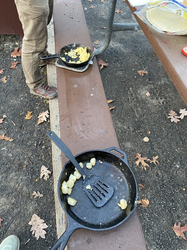
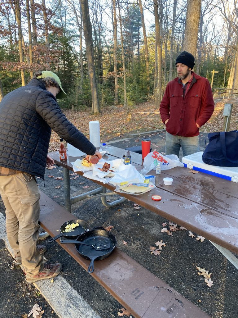
Pre-Hike: My alarm went off at 6 AM, and awoke the 3 of us. I managed to sleep OK (and not freeze) but Matt mentioned he was cold that night. We got to work on a fire, and Matt brought all the ingredients to cook us a fine hiker breakfast: eggs, bacon, black beans, potatoes, cheese, & salsa, wrapped up in a burrito! While all that cooked, we packed up.
We feasted on a breakfast of champions (hikers!) Thank you–again–Matt!


We left promptly at 8, stopped for gas along the way, and reached the Mount Davis parking lot by 8:45ish. We were the only ones there!
We planned to hike a 5.6 mile loop, after seeing the “summit,” so we didn’t need to take much with us.
Hike: We didn’t have a good map of the area, as I had planned to do this hike from the trailhead and not from the parking lot. The parking lot turned out to be easier to find, so we just checked out the posted map, then wandered down the paved trail a few minutes until we reached the summit.
This one, similar to Maryland yesterday, felt a bit anti-climatic. A (very) short hike, then an area with a bench and some informational plaques.
First, Joel and I had to climb the “summit” (a large rock) properly, and get a pic. Since the summit is a rock, on an otherwise flat area, I thought it earned the “Most Unique” award (so far in our journey–I’m sure there are other unique ones out there).


Then we read the informational plaques:


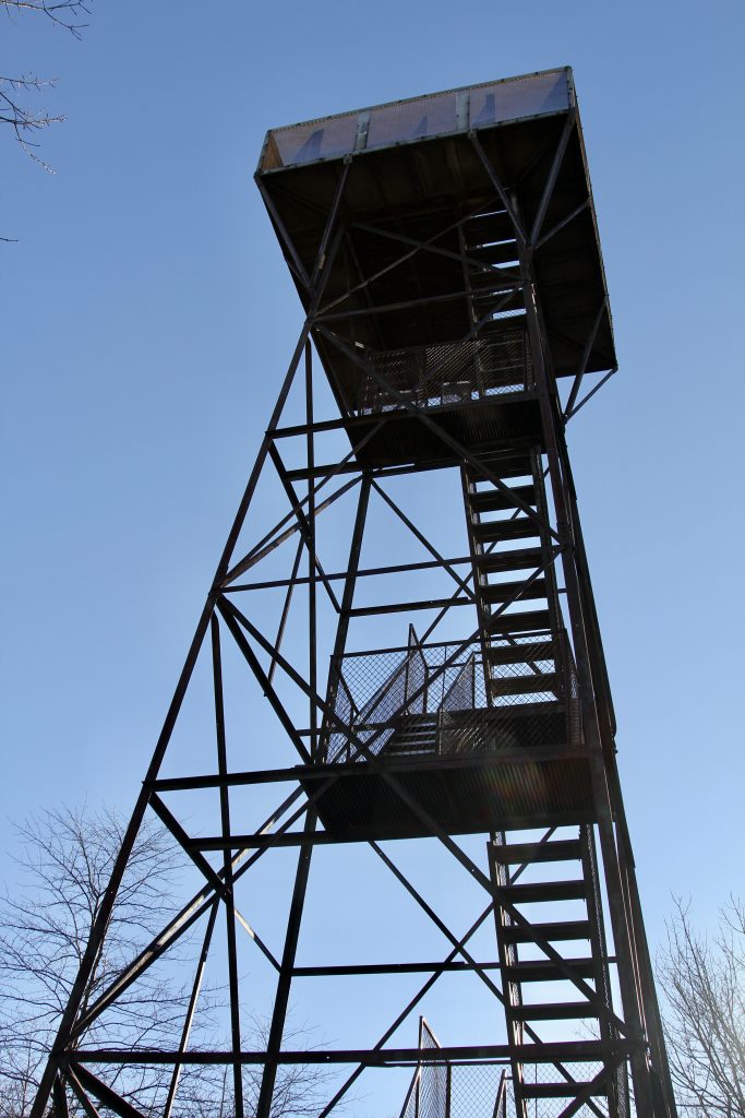
And finally, climbed the tower to check out the area:


The tower was a nice addition to the area, though it felt a little rickety to us.


We climbed down, returned to the car; I swapped my camera for my daypack, and left the trekking poles behind, thinking I wouldn’t need them.


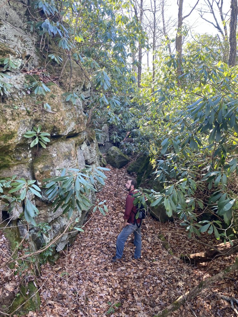
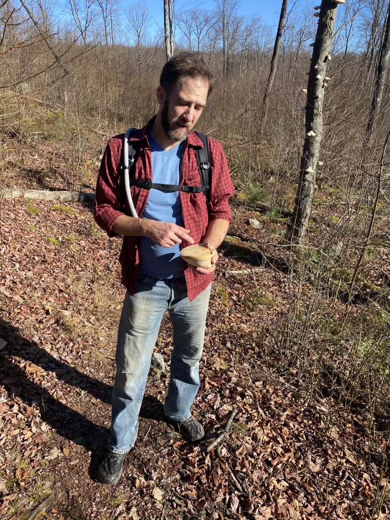
We hiked for a little over 2 hours, with not much noteworthy, other than a steep rocky drop-off (pictured above), some mushrooms, and the small stream running through the area (shown below).

My brothers both walk fast, so I brought up the rear for a good portion of this hike. The trekking poles might have been helpful, but thankfully my hip held up ok.


My legs still felt very heavy and tired from yesterday’s Via Ferrata (combined with camping out, where I never sleep very well), but thankfully this hike wasn’t too bad, until the end, when we had several uphill sections and I was just ready to be done and get driving home.
At last, we made it back to the parking lot, right before my desired time to leave, 11:30.
Our first siblings trip was a big success, and so much fun!

Post-Hike: After that, I had a long (very long!) solo drive back to NC–almost 6 hours. I listened to several podcasts, talked to my mom, and saw a chunk of America I had never seen before. I marveled that I left PA for MD, and in doing so, crossed the Mason Dixon line, then crossed the eastern continental divide, then went through the town of Cumberland, and along the old C&O (Chesapeake and Ohio, I would learn) Canal. I crossed the Potomac River, through the city of Paw Paw (which made me laugh) into West Virginia. Then several more backroads (and a 1 lane bridge) until I finally got to I-81. I stopped once, for a bathroom break and food–Taco Bell–and back on the road quickly so I could get home to my boys.
Side note: The town of Boones Mill, VA gets the award for most patriotic. The whole drive had plenty of fun political signs, stuffed figures, flags, 2-story cardboard cutouts, etc. but this town took it to a new level!

Recommend: This is one that you’d only do if you’re looking to climb the highest point in Pennsylvania. It was pretty, and I did enjoy reading the random stories on the plaques, but otherwise this was an average hike and less-than-stellar summit. However, since PA is our home state (and Matt & Joel still live there!) it felt good to get it crossed off our 50 States’ Summits list.
Map:

Up Next: I don’t know yet… I’d love a spring trip to Mt. Rogers, VA? Then we would have a good portion of the eastern seaboard completed.
The big trip next year (besides Disney & Germany–both postponed to 2021 due to the ‘Rona) is Mt. Rainier!

Forbes State Park – iconic indeed. Brother Matt’s cooking deserves first prize.
Honorable mention to your hip. I predict Mt. Rogers will be on your agenda shortly.
The noteworthy mentions of political signs have been very telling, and amusing.
Other than your encounter with the bear/noisy nearby campers, your safety has never been an issue.
The rickety hanging bridge (was that in Maryland?) and this tower in PA, your footing on rutty roads
or rock sides have all been manageable. Very glad for your partner Joel in this journey.
Happy Holidays to you and your family in PA! May the journey continue safely and with trekking poles into 2021.