Hike: In the middle of a lush fraser fir forest, Mount Rogers, VA stands at 5,729 feet above sea level. This peak is #19 on the 50 states list, and for us, was highpoint #12 completed. Since Mount Rogers is most easily accessed from Grayson Highlands State Park, we chose to take that route, via the Appalachian Trail.

Goal: The main goal for this trip was to do a “dress rehearsal” for Mount Rainier, which is now 2 months away. With very cold temps at Grayson Highlands, we knew this would be a great time and place to test our cold weather gear, and make sure we have a decent comfort level with carrying a 30 lb pack. We also hadn’t done any highpoint since Pennsylvania in November, which now feels like a long time ago 🙂 so this trip also got us back in the swing of hiking and preparing for harder hikes to come.
Gear: Lots of gear! In summary:
- My North Face 65L backpack, filled with the following
- Big Agnes tent
- Mountain Hardwear Rook 0° sleeping bag, and sleeping bag liner (purchased for my Euro Trip back in 2007!)
- Sea-to-Summit sleeping pad and pillow
- JetBoil stove + fuel
- Mountain House meals (3)
- Dry sack with rain pants, base layer pants, ninja-clava, hat, extra socks and undies, and medium weight gloves
- Outdoor Research (OR) parka
- 2 1-liter Nalgene water bottles + holder
- Toiletries and electronics bags
- Map
- Random others (compass, whistle, first aid, hand sanitizer, fire starter, ear plugs, GoPro)
- Worn: Altra Lone Peak shoes, Smartwool socks, OR pants, Smartwool tee + 1/4 zip, OR puffy jacket, light gloves, trekking poles, camera

Weather: Sunny & gorgeous, yet windy and cold. 37° at the start, dropping down to 18° that night!
Pre-Hike: My brother arrived Thursday, and on Friday 3/5, I took half a day off work. We headed out after an early lunch (delish burgers & onion rings à la Javi!) and the 2+ hour drive to Grayson Highlands State Park went quickly.
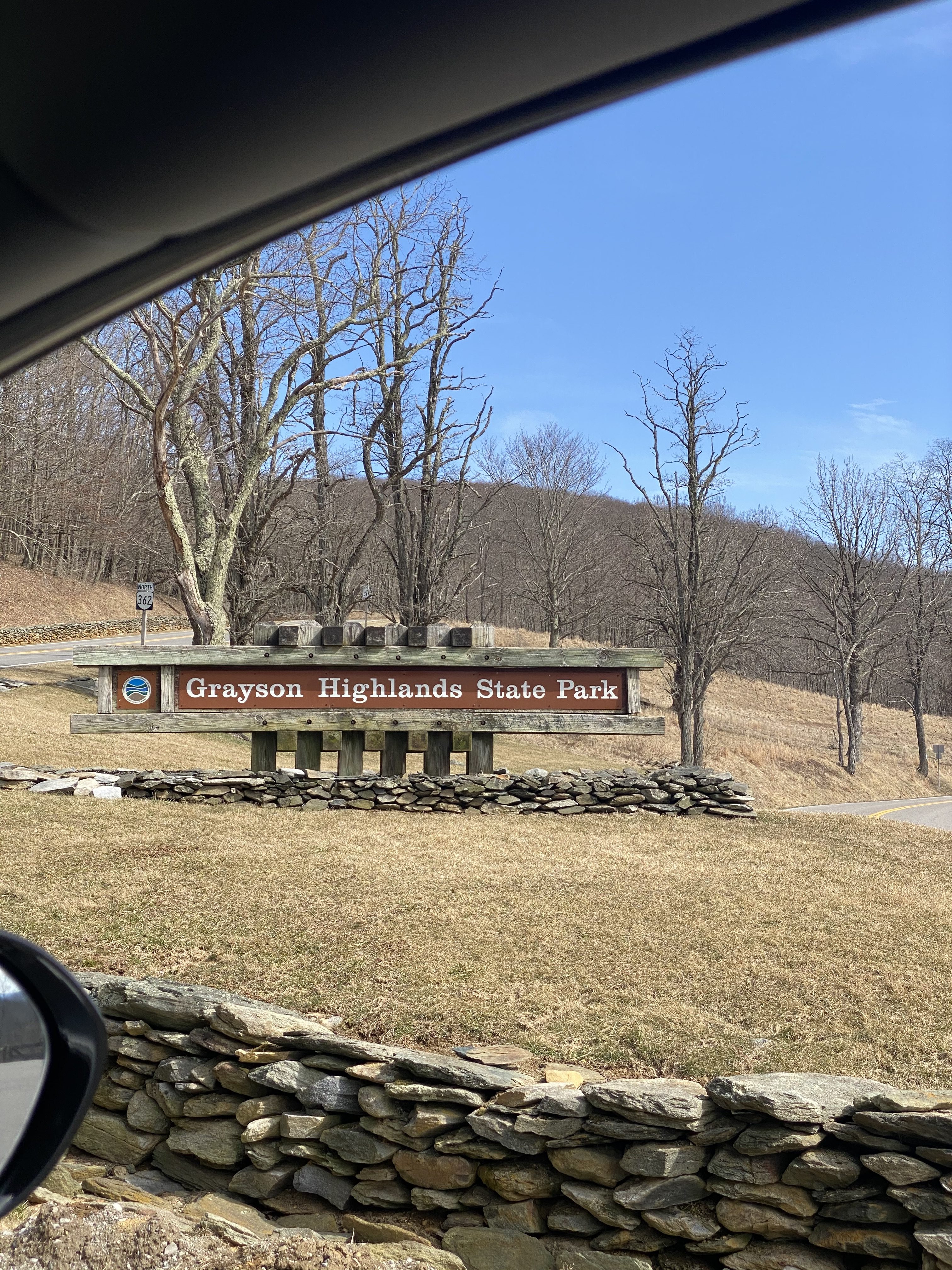
I made reservations in advance (recommended) for us to park the van at the Overnight Backpackers parking lot.
At the lot, an information stand contained our parking permit, and had a little paper to fill out with our info and whereabouts–just in case someone needed to come find us 🙂 We needed to be out of the parking lot by noon the next day, but our plan was to leave after hiking out post-breakfast.

The Hike: I felt slightly overwhelmed by the amount of gear I was carrying. Not the weight, but the new items and new hydration strategy, namely my water bottle holder (to try out prior to Rainier), and my GoPro. I decided the GoPro could go in my waist-strap pocket, to be accessible, but the water bottle holder I couldn’t quite figure out where/how I wanted it. It kept slipping to the center, so my leg would bump into it with every step… not ideal. On Rainier, water freezes easily, hence bringing Nalgene bottles instead of a water bladder, which is very likely to freeze.
Also, the wind made it really freakin’ cold, so I wore my light gloves at the last minute. I forgot my headband/ear-warmer at home, so I went without.
Finally situated, we set off on the Appalachian Spur trail!


We followed the spur trail 0.8 miles, through the forest and into the barren open spaces.

The blue blazes made it easy to find our way, and we saw a few other hikers too.


We said this hike reminded us of other hikes in NC and WV. Indeed, I could envision both Mount Mitchell and Spruce Knob here.


I enjoyed the mountain laurel and rocky peaks in the distance, but most of all, I wanted to spot the wild ponies that Grayson Highlands is famous for.
We made a left turn on the AT (southbound), and soon enough, we saw wild ponies!


The ponies, curious and friendly, came right up to greet us! I especially liked the momma pony (pregnant one) pictured above left.

The pony area was fenced in, and contained gates or little “pony puzzles” (a U-shaped fence that would bamboozle the ponies, to use Joel’s word for it) so they couldn’t get out.

We had a few more miles to go before our destination for the evening, Thomas Knob shelter. We wanted to stake out space at the shelter, drop our bags, then continue on the final 0.75 mile to Mount Rogers.

We saw maybe a dozen hikers, in groups of 2-3, and as we passed each group, I figured our chances of getting space in the shelter improved. I brought my tent just in case, but really wanted to sleep in the shelter for its wind protection (and likely bear protection), and less hassle of setting up / taking down the tent.
We continued on at a brisk pace, wanting to arrive with plenty of time for potential tent set-up, Mount Rogers spur trail hike, and dinner. We only stopped for taking these pictures, a quick sip of water, and when I couldn’t take it anymore (cold ears), to put my hat on. Otherwise, we just kept moving.
I felt surprisingly good carrying 30 pounds on my back, and made me very glad for my training in recent weeks (using a backpack on a Stair-Master… unconventional, yet effective!)
The trail goes through a rocky cave, shown below, which was really cool–but couldn’t take any pics because I needed both hands–and super icy.


After passing another pony gate, and mile marker 4.5 on my watch, we found Thomas Knob shelter! (Photos from later that evening)


The shelter looked like it would hold maybe 8 people in the 3-sided downstairs area… however, what I really wanted was to sleep in the loft!
I climbed the ladder to look around, noting that the second-to-highest rung was sadly missing, but to my surprise and delight, no one was there!
I yelled down, “Joel, we can sleep up here!” I felt so grateful that we’d be out of the elements, namely, the wind.
We set our bags down at the far end of the loft, in case others came along and wanted to join us. It seemed to have space for 6 people, if we packed in tightly. There appeared to be no rodents, but the trash leftover from other hikers littered the small space. How can people leave so much trash behind? I noted tarps, bungee cords, water bottles, energy drinks, chips, and other things. Even if I wanted to take some of this trash out, I wouldn’t be able to make a dent… I’d need an entire trash bag to fit all of this.
We slid the trash to one side, and left our bags there to stake our spots for sleeping later.
Mount Rogers hike: Joel grabbed some water, and I brought my camera and GoPro, and we headed out to Mount Rogers spur trail, not far from our shelter.
On the way, we saw even more ponies!


In just a few minutes, we found the spur trail up to Mount Rogers, also marked with blue blazes like the AT spur trail earlier.
I told Joel “Without the backpack, it almost feels like I’m floating up the trail!” He agreed.
We enjoyed the scent of fir and spruce trees wafting through the late-afternoon air. We remarked how much our mother would love this fir forest.


I had read about Mount Rogers being in the middle of a beautiful forest, and these accounts were 100% accurate.


The hike went quickly, with just a few icy patches slowing our progress. After about 20 minutes, the trail seemed to peter out. I looked around, and figured we must be at the summit. I saw a big rock, and Joel pulled up his map on the app. Sure enough, we found the summit marker!
Highpoint #12 = complete


After taking our usual pics, we didn’t hang out long–maybe 5 minutes–before heading back. We knew we needed to get a fire going to cook our dinner (sausages + peppers & onions, brought in a little soft-sided cooler from home).
I made this little 45 second video at the top:
We found our way back to the AT easily, and made friends with the ponies on the way back!


The pony with the bum foot became our friend. I think he was just looking for food though 😉 Poor guy might be in a lot of pain–I consulted with a few horse-expert friends. Hopefully he gets help.
My GoPro pony video:
Post-Hike:
Once back at the shelter, we grabbed the cooler, fire starter, newspaper, and lighter, and headed up the trail to find an adequate fire spot, since there was a sign at the shelter stating “No Fires.” I also grabbed my parka and gloves, figuring I’d get chilly without being in motion (I was right).
We walked maybe 200 yards up the trail (northbound) and found a fire ring among some trees, not far from the trail, but in a spot somewhat protected from the wind.
We got busy building the fire–all credit goes to Joel, who is a pro at getting fires going.


I prepped the food, giving Joel 3 sausages plus lots of veggies, with a splash of olive oil, and taking the other 2 sausages and remaining veggies in my foil pouch. I quadruple-wrapped them (4 sheets of foil each) so they wouldn’t burst open or lose any of the steam. We waited about 20-30 minutes until we had some really hot coals, then stuck our foil pouches in. Both of us had some hunger pains, and the next 15 minutes went by slowly as we waited impatiently for our food to cook.
At last, we had sausages and steamed veggies! Plus some hot mustard packages from McDonald’s for dipping 🙂 I have to say, food tastes especially good after hiking, and after cooking it ourselves over a fire!


The sun had already set by the time we packed up our trash and put out the fire with dirt, so we switched on our headlamps for the short walk back, stopping at the bear boxes to store our cooler with trash inside. This way if any bears smelled any remnants of our delicious dinner, they would go to the thick metal bear box, which is purposely placed away from campsites. It also has a very difficult mechanism for opening, so the bears can’t open the door or claw their way into the box.
A Very Cold Night
Back at the shelter, we hung around the first floor chatting for a bit, commenting how surprising that no other hikers wanted to sleep here at the shelter, and that our water bottles already contained ice. We had noticed at least 3 tents on our walk back from cooking dinner. I said, They’re going to have a chilly night tonight!
I didn’t realize that we would ALL have a chilly night. With the temps in the 20’s, I knew I would end up sleeping with all my clothes–and jacket and parka–on. And later the temps dropped into the teens!
My phone alternated between 1 bar of signal, and no service, so I sent some texts to the family, then got my sleeping bag, sleeping pad, and pillow ready. I didn’t have my base layer pants on yet, so when Joel went to brush his teeth, I got my base layer on, then put the outer shell pants over top. I also changed out of my damp socks into fresh ones. WOW that cold air shocked my exposed skin, and chilled me so much I needed to immediately climb into my sleeping bag. I also had on my T-shirt, Smartwool 1/4 zip, puffy jacket, ninja-clava, and hat.

This is where I realized mistake #1 of the trip: Bring extra thick socks for sleeping. Stupidly, I had left my thick Smartwool mountaineering socks at home, reasoning that I didn’t need to bring extra stuff for this overnight trip. Wrong! I wore my fresh pair, a medium thickness ankle sock, and wished I had the thick ones to put over these. My feet ended up being numb all night long 🙁
I waited awhile longer before crawling out of my cozy bag to go brush my teeth and go to the bathroom one more time before bed. The water I used to rinse my mouth had ice chunks in it, and hurt my teeth it was so cold.
We went to bed sometime around 8:30, since we had nothing better to do, and decided to set the alarm for 6 AM so we could cook breakfast and get an early start.
Joel said he put his extra jacket by his legs and feet, inside his sleeping bag, so I did that too, with my parka, since my upper body was warm but lower body definitely wasn’t.
As I tried to get warm and comfortable, yet couldn’t, I had a sinking feeling it would be a long night.
Just think warm thoughts… maybe it won’t be so bad.
First, my hands were cold. I put my pillow inside the hood of my mummy sleeping bag, but it left my head at an awkward angle, and I felt like I couldn’t breathe, since the bag covered most of my face. I ended up ditching the pillow.
Next, I slid off the sleeping pad onto the floor several times, making me wonder if the shelter was not level.
A chill zinged up and down my spine, yet I didn’t shiver.
Outside, the wind howled. I could only imagine what the people in tents were going through.
I tossed and turned with difficulty, since it’s hard to move in a mummy sleeping bag while cold.
Finally, after some time in and out of consciousness, I decided to do something different–though in my sleepy stupor, I wasn’t sure what I was going to do. What time is it? 11 PM… ugh.
I fumbled for my headlamp, put it on, and turned it on… right at Joel.
Of course, I woke him up.
What’s wrong? he asked.
I can’t sleep… my lower body is so cold, and I can’t get comfy at all.
I sat up, reluctantly shimmied out of my bag, grabbed the sleeping bag liner, and pulled it up to my waist. I took the parka from inside my sleeping bag and put it on, switching my phone and contacts (the things I wanted to stay warm) from the chest pocket of the puffy jacket to the parka chest pocket. I laid the emergency/space blanket over my sleeping bag and tried to tuck it in both sides of my legs. I put my earplugs in, hoping to drown out the howling wind. That’s a little better…
At some point in the middle of the night, I realized that I had a draft coming up underneath me. It was the sleeping pad! Note to self: get a cold weather sleeping pad for next time.
The Next Morning
I managed to sleep until 5:30ish, but not without waking up several more times, with a freezing face, and wishing my feet weren’t numb.
When the alarm went off at 6, I happily yet tentatively got up, knowing that as soon as I started moving, I’d warm up.
Putting my feet in cold shoes wasn’t fun, but I visited the privy (20-30 yards away) and was glad for a place to sit, albeit a cold seat!


We decided to heat our water for breakfast in the opening of the shelter, so I got to work setting up the JetBoil. We barely had enough water to boil, since both of ours froze during the night.
And after boiling the first two cups of water (enough for one Mountain House freeze-dried breakfast skillet, and 3/4 cup left for hot tea), my stove went out. I was out of fuel!
We shared the breakfast, and I gave Joel the bigger portion. I tried to eat a Clif Bar, but it too was frozen. I drank the hot tea and had a bit of chocolate.

We packed up quickly, stopping by the bear canister for our bag, then hit the trail around 7 AM. We saw a few other hikers, but mostly walked alone.


We scurried along, making good time, and only stopping for a few pics. We had a big day ahead of us, going to Black Mountain, KY, and then on to Devils Bathtub, VA, before driving the 3.5 hours home!


We made it back without incident, and I felt the usual relief when I saw the van was still parked there (and no one broke in). What an awesome trip!
Recommend: For sure! Even with the frigid temps, I’d give this a 10/10–the views were amazing, the ponies were so cute and friendly, and I thoroughly enjoyed Grayson Highlands State Park. Mount Rogers itself isn’t spectacular–though the forest is beautiful, it doesn’t have the same views as a Mount Marcy or a Mount Mitchell, but combined with the nearby land and ponies, it made for an excellent overnight adventure.
Maps: I stopped my watch after reaching Thomas Knob shelter, so there are 3 maps–the initial hike out (4.5 mi), the hike up to Mount Rogers right after that (1.5 mi), and the hike back the following morning.


Up Next: A “quick” (3 hour) drive to Kentucky’s Black Mountain.
In 2 months, we are going to Mount Rainier! My training has been going well, and this trip gave me the confidence I needed to sleep out in the cold. I will be buying a few more pieces of critical gear, and continuing to train hard, but otherwise I feel like I’m ready to go 🙂
Cannot imagine being that cold, or brushing my teeth with ice cubed water.
One night in these conditions, training on a stair-stepper and you are ready for Ranier. Oh, my.
The spruce/fir forest looks majestic. Such sweet ponies – next time, take them carrots and you, mega thick
Smartwool socks. At what point/temperture does the Forestry Dept. shut down the trails? or do they.
Thanks for keeping the GoPro charged up. As usual, love the vegetation and food shots.